The first part of this review/blog has been compiled prior to the trip. This part is included under ‘The Planning’. The second part. ‘The Reality’ will be/has been completed after the location has been visited.
Dubrovnik: The Experience
The first part of this review/blog has been compiled prior to the trip. This part is included under ‘The Planning’. The second part. ‘The Reality’ will be/has been completed after the location has been visited.
Leg 6: Salerno (LIRI) to Dubrovnik (LDDU)
This is relatively short leg of 200 miles, 50% over land, 50% over the Adriatic Sea. From Salerno Airport the track is ENE on magnetic 060° across the Campania and Puglia regions of Italy crossing some medium sized terrain, the highest spot under my track being 4,600′.
Leg 5: Elba (LIRJ) – along Italian west coast to Salerno (LIRI)
On this trip there are two routes which have been designed to take in coastal scenery. This leg from Elba to Salerno and the leg from Dubrovnik to Vienna. Both of them should have beautiful views. This leg along the West (Tuscan) coast of Italy is 258 miles over the Tyrrhenian Sea. After departure from…
Leg 4: Corsica (LFKB) to Elba (LIRJ)
The shortest leg of my entire trip. The route is ENE from Bastia on magnetic heading 065° with a distance of just 36 miles.
Leg 3: Cannes (LFMD) to Corsica (LFKB)
The second shortest leg of my trip. Only the last 12 miles of the 145 mile leg is over land. I have read other posts on pilot forums on which a lot of private pilots are concerned about long legs over the sea. It’s not something that troubles me. I think it is simply a matter…
Leg 2: Clermont-Ferrand (LFLC) to Cannes (LFMD)
The leg from Clermont-Ferrand to Cannes is just over 200 miles (211) on a magnetic heading 130°. Just before the half-way point the track crosses overhead Valence Chabeuil (LFLU) then continuing SW to Cannes. Below is the route as plotted on SkyDemon.
Leg 1: Jersey (EGJJ) – Clermont Ferrand (LFLC)
The overall leg length of the ‘French portion’ of my trip is a little over 500 miles. It has to be broken into a minimum of two sectors (unless I have a ferocious tail wind on my day of departure). Originally I had split the trip into a 200 mile (approx) leg from Jersey to…
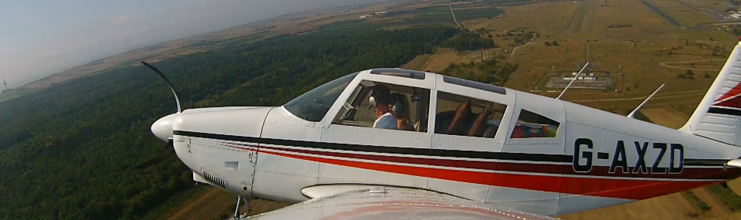
In Flight Filming
Lights, Camera, Action! In this section I look at filming during flight: mounting cameras and other useful information.
More Detailed Route Planning: Sources
In this section I provide information about paper charts and electronic navigation
The Route
The map shows the approximate route with the main stops. It was the first stage of planning and was created by simply asking the question, “Which places would I like to see?”
Introduction
This site is predominantly to serve as a record of an exciting VFR flight during August 2015 beginning and ending in Jersey in the Channel Islands. I’d like to keep a record for myself. But, I thought it may be helpful to other pilots to obtain information about my experiences and see pictures and…
